A journey into the past: geology
The Upper Rhine Graben in its current extent from Basel in the south to Frankfurt am Main in the north is a rift valley that reached deep into the earth's crust and was later filled with sediments. Here, the heat balance in the subsurface is determined by a positive temperature anomaly. The Geoenergy & Utilization subpage explains exactly what this is and why this region is so well suited for geoenergy utilization.
The trench fill reaches a thickness of more than 3 km in places and consists of different sediment layers that have been deposited on top of each other over millions of years. These layers are named after the time period in the earth's history in which they were deposited or after a location in which they are found. Their composition gives an indication of the environmental conditions at the time of their deposition. In the Upper Rhine Graben, they bear witness to an eventful history in which this region was characterized by a lake and river landscape and was repeatedly washed over by the sea.
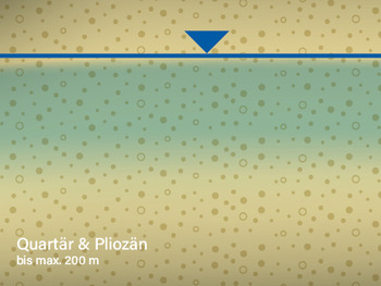
The youngest sediments are found here. In the Quaternary and Pliocene, mainly sands and gravels were deposited. They are used as aquifers at KIT Campus North, as in many regions in the Upper Rhine Graben. In order to protect them, the DeepStor borehole in the Pliocene-Quaternary sediments will be isolated from the groundwater-bearing layers by a total of three casings, so that the possibility of deep water entering the groundwater can be ruled out. In addition, groundwater monitoring with a high temporal and spatial resolution will be installed to monitor groundwater quality.
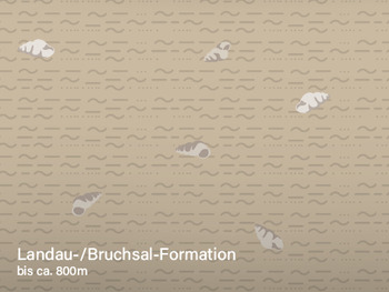
Landau- /Bruchsal Formation up to approx. 800 meters, Age of deposition: approx. 25 - 16 million years
The Landau formation and the underlying Bruchsal formation are mostly marl, consisting mainly of limestone and clay.The marl layers are interruptedby marine and brackish dolomite and limestone. Fossils such as Corbicula (shell genus) and Cerithia (snail genus) can be found here. The Landau Formation is dominated by marl from freshwater deposits, in which the Hydrobia (snail genus) can be found. In the Landau and Bruchsal formations, there are only isolated sandy layers that could serve as reservoir rocks. At the time of deposition of both formations, there was a high level of tectonic activity.
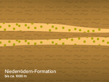
The sediments of the Niederrödern Formation are characterized by green, grey, red, ochre ("colourful") marls, into which the first, thicker fluviatile sandstone layers and lenses were deposited in channel systems. The Niederrödern Formation is relatively poor in fossils. A few plant remains and coals occur and indicate continental, fluviatile-lacustrine depositional conditions. During this time the sea had retreated, there were lakes and swamps, and rivers unloaded their cargo.
Froidefontaine formation up to approx. 1400 meters,Age of deposition: approx. 32 - 28 million years
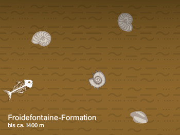
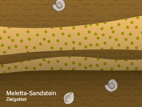
The sediments of the Froidefontaine Formation are characterized by uniform grey marls with intercalated sandstone layers, which were deposited under marine conditions. Fossils are not uncommon and in some cases give the formation its name (e.g. foraminifera marl, fish shale, meletta layers, cyrene marl). The Froidefontaine Formation, like the overlying formation in the area of "oil traps" - as at Leopoldshafen - can be oil-bearing. The salt content in thein the sandstone layers is very high:1 liter of water contains about 120 g of salt. The embedded sandstone layers are to be investigated as possible reservoir rock in DeepStor.